
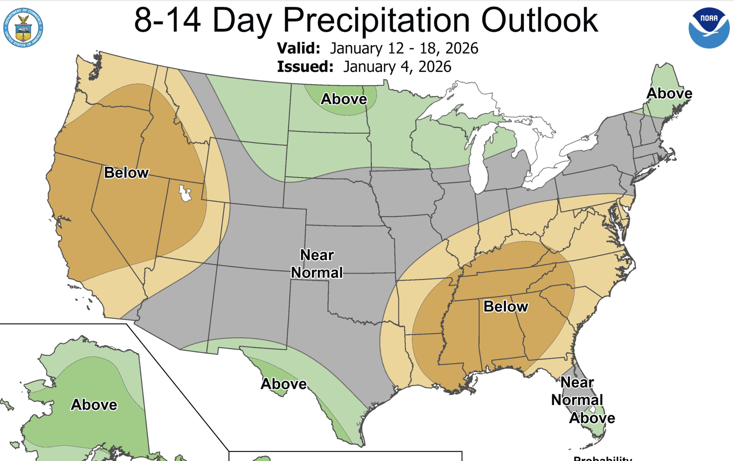
Like a switch being turned on and off, the AR led wet weather and waves of storms coming in from the Pacific that most of California saw over the holidays will feel the return for at least 10 days of “the blob” – high pressure off the coast and warm and sunny blue skies across the Golden State but likely fog in the SJ Valley.
Here is the Climate Prediction Center January 4 forecast for 12th -18, 2026.
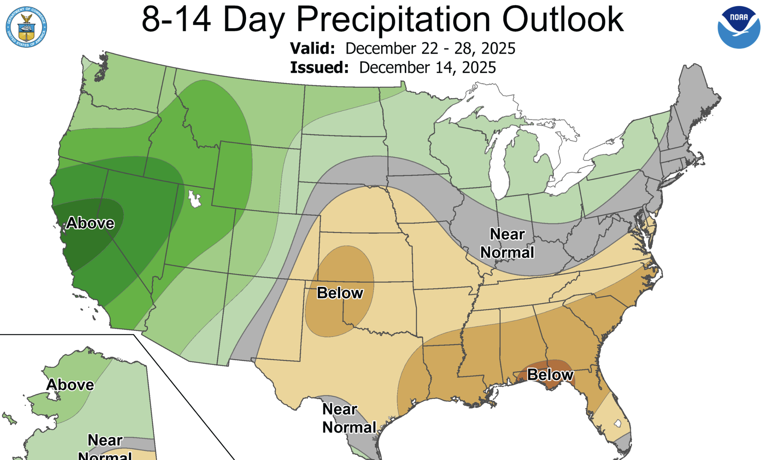
Multiple atmospheric rivers resulted in above-normal precipitation and flooding across California and the Pacific Northwest during mid to late December. 14-day precipitation, from December 18-31, averaged more than 200 percent of normal throughout California with southern parts of the state receiving more than 4 times their normal amount of precipitation during this two-week time period.
Contrast the latest map with what was predicted a few weeks ago
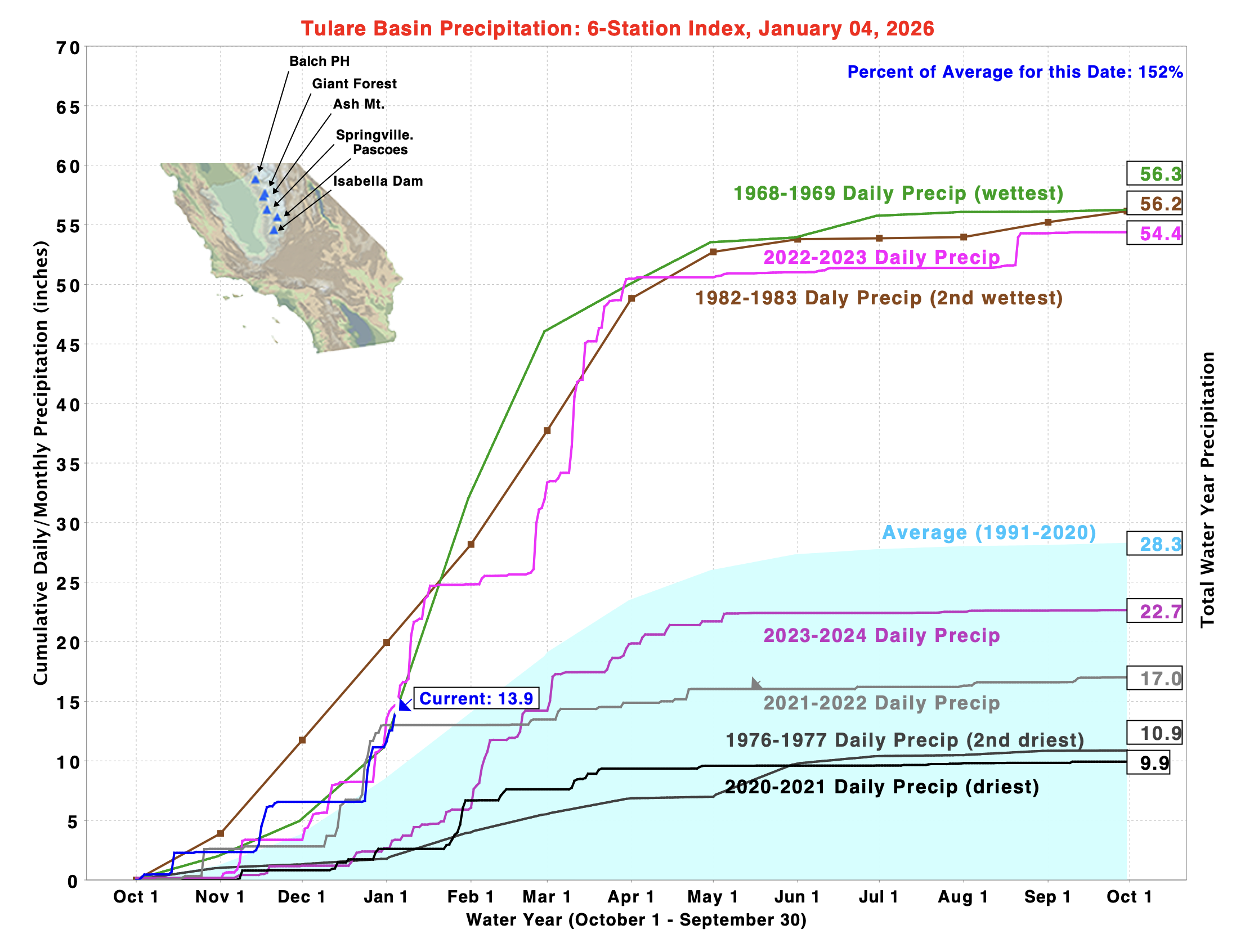
Precipitation is above average across the state, including in the San Joaquin and Tulare Basin stations – both about 150% of average for this time of year.
On the coast Lake Nacimento has received 7.25 inches of rain so far this water year compared to 2.29 inches this time last year. The lake is the water supply for San Luis Obispo and other towns. In our hometown of Los Osos we have received 12 inches of rain so far, 2/3 the average amount of 18 inches for the year.
The state’s most important reservoirs are doing well with Shasta storage at 128% of average and Oroville at 141%.