
May 11,2015-
While most of us have about given up on more rain at this point – given the calendar – a series of cold winter storms seem to be bearing down on Mid California from about May 15 through the 24th. These storms originate in the Gulf of Alaska and look to drop snow up and down the Sierra and rain on the Coastal and SJ Valley floor just as you are gearing up for Memorial Day.
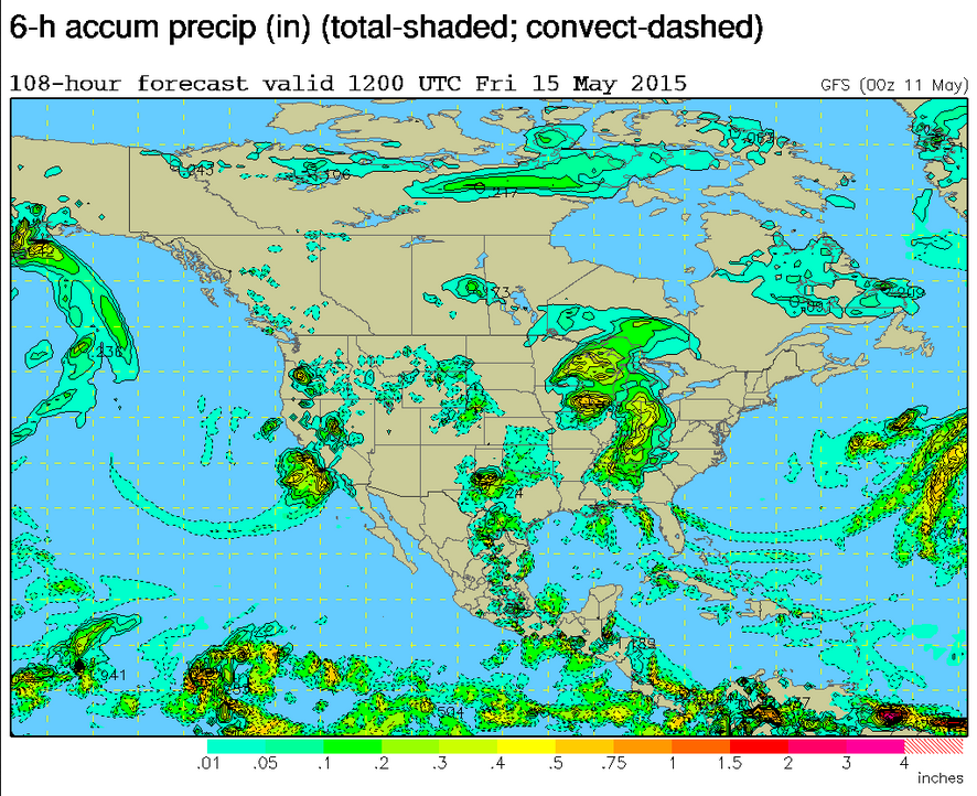
On Friday May 15 the first of these lows has a bulls-eye on Central California before it moves up the Sierra with perhaps half an inch both on the Coast and in the Central Valley ( see map).
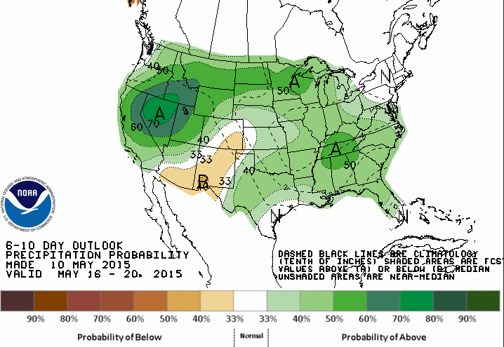
Beyond this coming weekend May 18 through the 20th looks good for a wet pattern for Northern California where reservoirs need it badly. (see 6 to10 day outlook map.)
Of course it typically does not rain much in Middle California in May with Visalia receiving an average of 0.23 inches for the month. Hopefully Visalia will see that much this weekend.
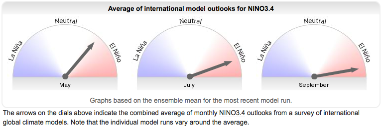
Also helping to boost hopes for a wet fall/ winter to come are censuses forecasts that El Nino,the warming of the Pacific waters along the equator – is likely to get stronger, that is warmer as the year goes on. Right now the water temps have increased from just the past few months from about 0.5 degrees warmer than normal to 1 degrees today, considered a moderate to strong El Nino. El Nino 3.4 SST anomalies shows this winter.
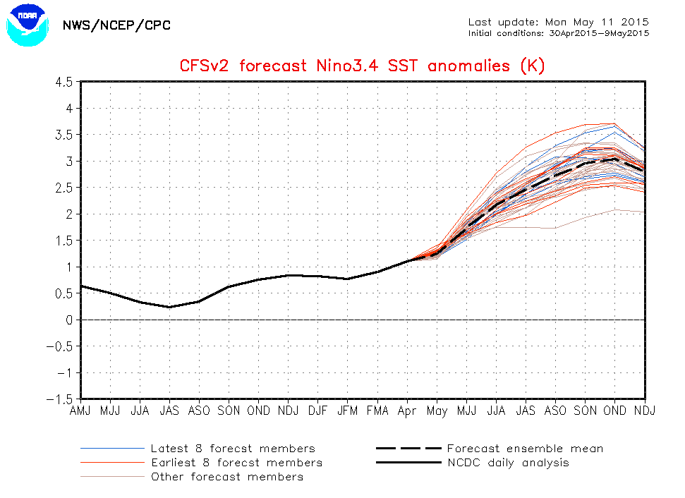
El Nino could reach 2 to 3 full degrees warmer than normal, a very strong El Nino ( black dotted line). That would increase chances for a rainy winter in 2015-16 around here.