
Friant Water Users General Manager Ron Jacobsma says they are anticipating a fall release for the long awaited Temperance Flat reservoir draft EIR from the Bureau of Reclamation.The huge project has been estimated to cost between $1 billion to above $3 billion.
Temperance Flat Dam is a proposed dam project on the San Joaquin River west of Auberry, California. The dam’s main purpose would be to supplement storage capacity in the upper San Joaquin River basin, greatly increasing the amount of water that could be used instead of lost to the sea in years of high runoff. Under the largest proposal, Temperance Flat would nearly quadruple reservoir storage in the San Joaquin basin above Friant Dam although the latest plan appears to increase overall storage by about 3X.
Temperance Flat is the key SJV reservoir backed by Central Valley water interests who argue that the storage will help save water in a wet year to not only supplement deliveries to farmers and municipalities but to assist in the ongoing restoration of the San Joaquin River to promote a salmon fishery. The fish require cold water to help them survive in the Valleys rivers in the torrid summer months.
The call for more storage jibes with Tulare County Board of Supervisors recent letter opposing any state water bond that does not include money for more surface storage – dams. Jacobsma says Friant’s 31 water districts are allied with ACWA (Association of California Water Agencies) position supporting storage as a part of the bonds. AWCA’s proposal is in the neighborhood of $8.2 billion including some for Temperance Flat while a smaller rival plan comes in at $5 billion with little for storage says Jacobsma.
In June Jacobsma says “We learned that Temperance Flat Reservoir is still looking feasible, but operations, costs, bond eligibility for public benefits and issues related to water supply, water quality and project beneficiaries all need further analysis.”Development of the proposed.Temperance Flat Reservoir has been studied extensively in recent years and, although much analysis is still needed, a number of objectives have been identified with progress made on planning project details, Jacobsma said.
Study of the big dam has been going on for more than ten years.
Critics have said the Bureau is unlikely to show that the benefits of the huge project exceed the costs and that the dam would flood remaining wild sections of the river and some fish habitat.
Known as the Upper San Joaquin Basin Storage Investigation, Temperance Flat’s feasibility study has identified design, capacity and operational characteristics that would increase water supply and system flexibility for farm, urban and environmental water uses in the valley and other parts of California says Jacodsma.
“We continue to encourage Reclamation to supplement the feasibility study with analysis of how Temperance Flat might be integrated into other parts of the south-of-Delta water supply system,” Jacobsma said.
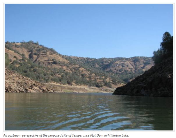
The favored Temperance Flat Dam site is located within the existing Millerton Lake, a short distance upstream from its confluence with Finegold Creek in Madera County. It would create a reservoir of up to 1.2 million acre-feet while modestly reducing Millerton Lake’s capacity.
Millerton Lake, formed by Friant Dam northeast of Fresno, is the primary storage facility for the Central Valley Project’s Friant Division but has a comparatively small storage capacity of 520,500 acre-feet. That capacity is called upon to control average annual runoff of 1.8 million acre-feet.
Temperance Flat Reservoir would be larger than Millerton Lake and all of the many existing upstream hydroelectric power reservoirs combined.
It would capture high flows generated by above-average water years.
Such flows currently are mostly “spilled” as flood releases because of a lack of Millerton Lake capacity and conveyance capacity constraints in the Friant-Kern and Madera canals, that limit Friant Division groundwater recharge and banking opportunities in above-average water conditions.
That recharge could help turn around the Valley’s declining groundwater levels.