
February 18,2015-
Although February started out promising it turned into a duster rain wise. High pressure remains in control looks like through the rest of the month. Both Central Sierra ski resorts closed due to lack of snow or cold weather to make it and farmers fretted we will have the 4th year of the California drought.
But hope springs eternal as major weather models are suggesting it will get wet in many parts of California including mid-state starting around February 28 and lasting at least a week with multiple cold storms coming in. Here is the GFS long range map for March 3 showing an atmospheric river effect from the south as well. Still, two weeks out you can’t count on it but it does look like an encouraging pattern just in time for Spring.
Watch the long rang patterns yourself – click on the GFS models at this site – http://www.cnrfc.noaa.gov/weather_models.php
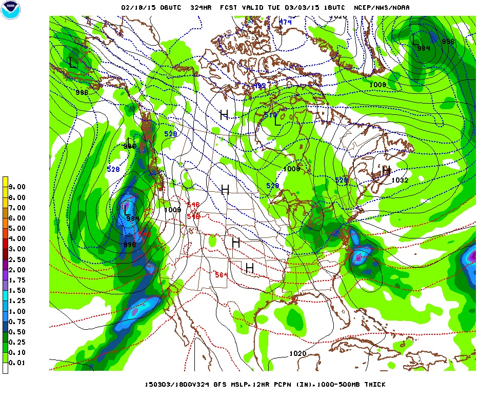
early March wet pattern