February 4,2015
What the NWS calls a ‘very wet storm system will be moving through Northern California starting Thursday afternoon across the northwestern portions of the state, then shifting southeastward Friday into Saturday.”
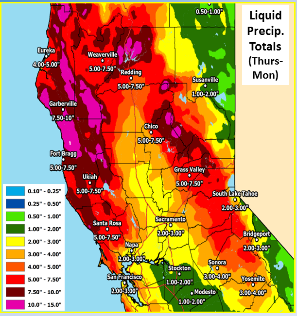
The heaviest rains (and greatest potential for local flooding) are expected generally from I-80 northward, though all of NorCal will receive a good soaking.
Perhaps pumping up the volume of water is the fact this is an extremely warm storm with .sea surface temperatures immediately offshore of California extremely elevated–and are locally more than 3-4 F above average for this time of year. These near-record temperatures could provide some extra moisture to the incoming storm systems, as occurred during the December storm sequence in NorCal.” says one forecaster.
Storm should soak Central California by Saturday.
Note the pink around Lake Shasta that indicates 10-15 inches of rain over 4 days.