
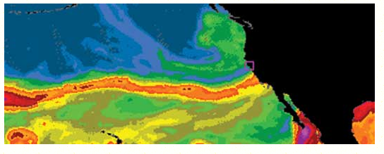
Just days after a soaking winter storm hit the state NOAA announced that its scientists and colleagues are installing the first of four long-term “atmospheric river observatories” in coastal California this month to better monitor and predict the impacts of landfalling atmospheric rivers. These powerful winter systems, sometimes called “pineapple express” storms, can be beneficial, in that they help to fill the state’s reservoirs, but they can also cause destructive floods and debris flows.
The coastal observatories, which are arrays of custom instruments, are being installed in
collaboration with the California Department of Water Resources and Scripps Institution of
Oceanography, University of California San Diego. The observatories will give weather
forecasters, emergency managers and water resource experts detailed information about
incoming storms such as winds and water content.
“California needs to know how and where it might rain or snow, when and where to
expect flooding,” said Michael Anderson, Ph.D., state climatologist with the California
Department of Water Resources. “The observatories will also help state officials and scientists
monitor changes in atmospheric rivers associated with climate change.”
This month’s installation of an atmospheric river observatory in Bodega Bay, Calif., will
be followed by installations at Eureka, Point Sur and Goleta. The move to set up the four
observatories and other weather instruments throughout the state came after NOAA
researchers and academic scientists spent several winters testing and selecting the most
effective arrays of instruments for collecting useful information for decision makers. Installation
of all four observatories is expected to be completed by early 2014.
“With satellites, we can see the tell-tale water vapor signature of an incoming
atmospheric river over the ocean. However, NOAA’s offshore observing systems do not
measure another key factor—strong low-altitude winds,” said Martin Ralph, Ph.D., a research
meteorologist and branch chief in NOAA’s Earth System Research Laboratory in Boulder, Colo.
“With our new sensors, we’ll be able to measure those winds and more, to understand just how
much moisture is moving in, which largely controls how extreme the precipitation inland will
become. This information will ensure that meteorologists and emergency managers have
additional information to keep the public informed about these potentially destructive storms.”