-March 7,2023- 7AM
NWS is upping estimates of high elevation rainfall that could repeat history in Sierra foothills towns like Three Rivers in Tulare County that has a history of floods.
But Terminus Dam project manager Bill Miller says he understands the AR will hit more to the north of Lake Kaweah – about down to Pine Flat Dam closer to Fresno.”We have 57,842 AF in the reservoir and can handle e 180,000AF. We aren’t building any ark here.”
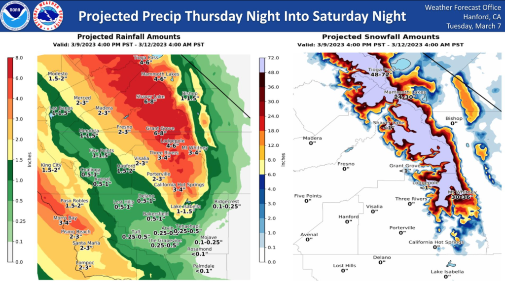
Central Coast could see 4 inches (see map)
More next week
From NWS Hanford
A strong storm system over the Eastern Pacific Ocean will approach
the coast of the Pacific Northwest Thursday night and Friday. An
abundance of subtropical moisture will move inland over Central
California along the southern periphery of this storm system
Thursday night and Friday. A mild air mass assoicated with this
storm system will cause snow levels to rise to at least 8,000 feet
Friday. In addition, heavy rainfall coupled with this mild air
mass will result in rapid snow melt from 2,000 feet to 5,000 feet.
Water levels on rivers and streams will rise and flooding is
possible.
Rain amounts Thursday night through Saturday night will be one
half of an inch to one inch in the western portion of the San
Joaquin Valley. Rain amounts Thursday night through Saturday night
will be one to two inches in the central portion of the San
Joaquin Valley. Rain amounts Thursday night through Saturday night
will be two to three inches in the eastern portion of the San
Joaquin Valley. Four to six inches of rain is possible in the
Sierra Nevada foothills and six to eight inches of rain is
conceivable in the Sierra Nevada below the snow line. Most of this
rain will fall Thursday night and Friday.
Here are probabilities of rainfall of three inches or more for select locations in the
Sierra Nevada and adjacent foothills from 4 PM PST Thursday, March
9th until 4 PM PST Friday, March 10th, 2023:
Yosemite Valley – 71%
Shaver Lake – 71%
Dinkey Creek – 71%
El Portal – 66%
North Fork – 61%
Mariposa – 61%
Oakhurst – 56%
Lodgepole – 56%
It looks as if there will be a brief break in precipitation Sunday
into Monday morning, before the next storm system impacts Central
California. It is a very active weather pattern, to say the least.”
AccuWeather: People and businesses are already cleaning up from previous storms, meaning that the latest storm has the potential to become a disaster upon previous disasters, further compounding any impacts,” AccuWeather Chief Meteorologist Jonathan Porter said. “Additional storms are expected into next week – which also may tap into a 2,000-plus-mile feed of deep subtropical Pacific moisture yielding heavy rain at lower elevations and heavy snow in the mountains.”
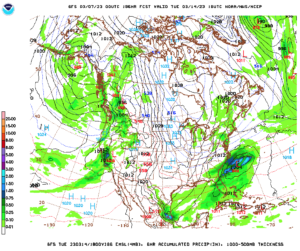
Pictured:GFS weather map forecast for next Tuesday as the AR keeps coming