
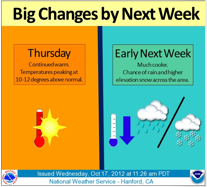
 Both Central Coast and Central Valley weather forecasters are predicting a few wet days next week.
Coastal forecaster John Lindsey says (0n 10/18) ” A strong cold front will move down the California coastline on Monday.
This cold front will pass the Central Coast Tuesday morning with strong to gale force (25- to 38-mph) with higher gust southeasterly
winds and rain. At this time, rainfall amounts should range between
0.75 and 1.00 inches. Rain showers are forecast on Tuesday afternoon
through Wednesday.
Not only will this be the first widespread rain of the season for
California, but it will probably be the first big snow for the
Sierra. Snow levels are forecast to get down to 5,000-feet or
lower across the Sierra by Tuesday and Wednesday with over a foot
or more of snow possible from the storm.
This cold front could be followed by another one late next week
before fair weather returns over the following weekend and through
the end of October.”
According to the National Weather Service,Hanford – this current heat will give way to moisture.
“THURSDAY IS EXPECTED TO BE THE WARMEST DAY WITH TEMPERATURES 8-13 DEGREES ABOVE NORMAL FOR MID OCTOBER. THE RIDGE WILL BEGIN TO BREAK DOWN FRIDAY AS A TROUGH OF LOW PRESSURE DROPS OUT OF THE GULF OF ALASKA. THIS WILL BRING INCREASING ONSHORE FLOW THROUGH THE WEEKEND WITH TEMPERATURES COOLING TO NEAR NORMAL BY SUNDAY. THIS TROUGH ALSO KICK THE CLOSED LOW OFF THE BAJA COAST EASTWARD AND INTO ARIZONA BY SUNDAY NIGHT.
THE MAIN ENERGY WITH THE TROUGH WILL REMAIN TO OUR NORTH THROUGH
THE WEEKEND. THEN THE LOW WILL DEEPEN FURTHER AS THE CLOSEDLOW
OFF BAJA IS EJECTED EASTWARD. ECMWF/GFS AND ENSEMBLE MODELS
SHOWING INCREASING CERTAINTY ON POSSIBLE PRECIPITATION OVER
CENTRAL CALIFORNIA AS EARLY AS MONDAY AFTERNOON AND CONTINUING
THROUGH TUESDAY AND WEDNESDAY. THERE ARE TIMING AND STRENGTH
DIFFERENCES WITH THIS SYSTEM BETWEEN THE GFS AND ECMWF…SO TIMING OF THE BEST CHANCE OF PRECIPITATION IS UNCERTAIN. BUT BOTH MODELS INDICATE A WETTER AND UNSETTLED PERIOD FOR THE FIRST HALF OF NEXT WEEK.”