January 25,2016-
Southern California will not have to wait much longer for El Nino to bring in moist Pacific storms as wet weather looks to blanket the entire state starting this weekend into the first week of February.
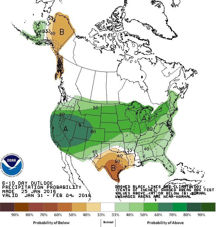
NOAA’s 6 to 10 day Precipitation Outlook map tells the story(click map to enlarge).
A second map of precipitation totals over the past week shows how northern California has been favored receiving cold Alaska storms that have helped build the snowpack in the Sierra and reached as far down as San Luis Obispo and Tulare County with several inches rain during the week.
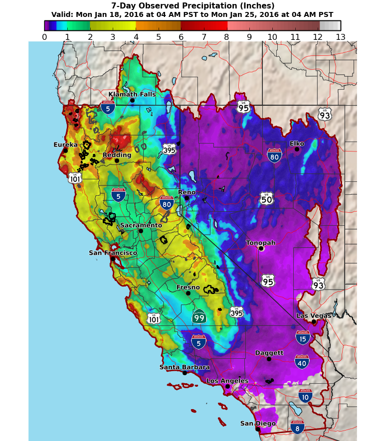
January so far has not been too shabby for California breaking the pattern of Januarys for past four years (see map).

But southern California to date has not received the soaking that has piled up snowdrifts in Tahoe and pounded the Shasta region this year.
Now we may be getting the full El Nino effect in February that typically is the wettest month of the year in the Golden State.
In a LA Times story this week some questioned whether El Nino “wimped out” this year.But it is too early to conclude that.
“During the last two strong El Niños on record, the heaviest rains came during February 1998 and March 1983, said Bill Patzert, climatologist for NASA’s Jet Propulsion Laboratory in La Cañada Flintridge.”
Give us a week and we will see the next chapter.
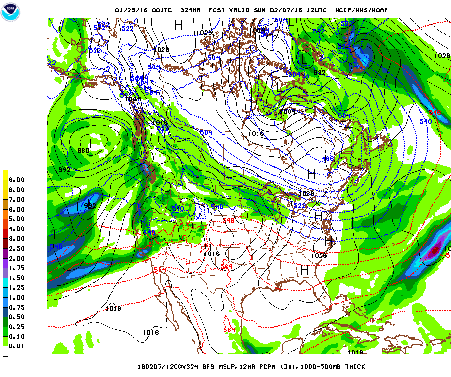
Already this weekend there is a firehose aimed at California in an Atmospheric River pattern- see GFS map.
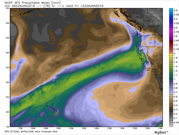
Here( below) is a weather model showing a clear Atmospheric River pattern extending from the western Pacific into the state with a bullseye on San Luis Obispo around February 7th. The GFS model suggests wet weather soaking much of the state February 3 through at least February 8th. Storms take turns hitting both northern and southern California beyond the 8th as well NOAA models predict.