
June 1,2015-
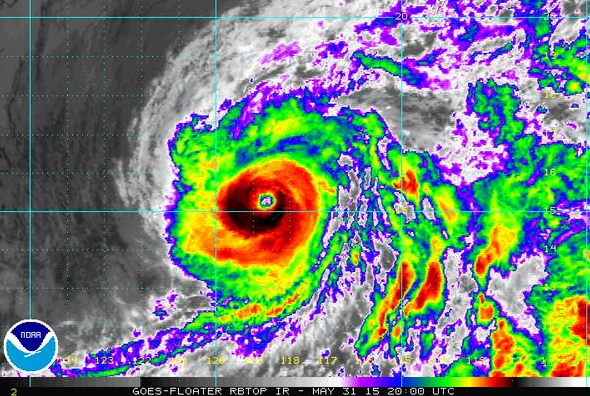 California could get an early Christmas gift next week – an El Nino spawned Hurricane spreading wet weather over a good portion of the state. El Nino typically visits this part of the world around Christmas but its surprisingly strong strength this summer could yield an early season surprise or two.
In the past week the National Hurricane Center issued its eastern Pacific hurricane outlook, saying that there’s a 70 percent chance of an above-normal number of storms this year as El Nino strengthens and Pacific waters warm.
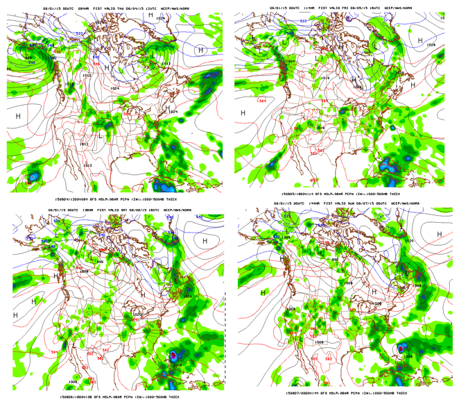
Right on cue Hurricane Andres is rotating off the Baja coast with 125mph winds,with latest NOAA GFS model forecasting the storm approaching the extreme southern end of California on June 4, ( the top left frame in the graphic) moving up the state on June 6 and spreading showers across much of the state by June 7 ( the lower right frame on the map).
The potential for showers here comes at a time of the year when no one expects any rain even though we desperately need it.
Watch your local forecast in coming days for an update on the path of the storm that of course could just as easy head into Arizona without much impact on the rest of the California.