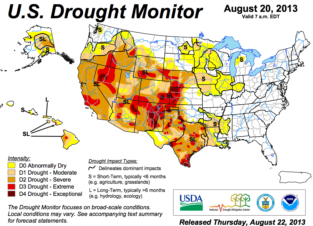
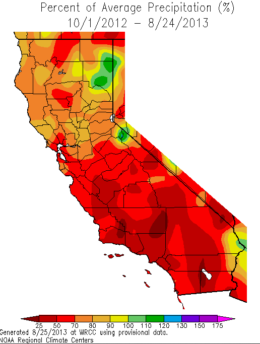
 The latest edition of the NOAA Drought Monitor map published late last week shows SLO County and region in ”Extreme Drought”conditions. A second map from CalClime shows rainfall 25% to 50% of average in the area (colored brown) in the past year. The past 8 months have been among the driest across the West. In California there is a few wet spots near Lakes Shasta and Tahoe.
 This is the first time that SLO County has designated Extreme Drought conditions since the U.S.Drought Monitor started up in 1999.
SLO weather forecaster John Lindsey write in his column this weekend that “the past two rain seasons (July 1-June 30) have seen well-below-average precipitation. In fact, this year’s January-June period for the city of San Luis Obispo will go down as the third-driest such period on record at Cal Poly (home of climatology for the city) since 1870, when weather observations started.
Since January, Cal Poly has recorded only 3.5 inches of rain. Normally, it should have received about 15 inches.
The county’s extreme drought condition will continue to increase competition for water among agricultural, environmental, residential and industrial interests, and as the price of water increases, conservation will become progressively important.”
