
Tule fog makes the news
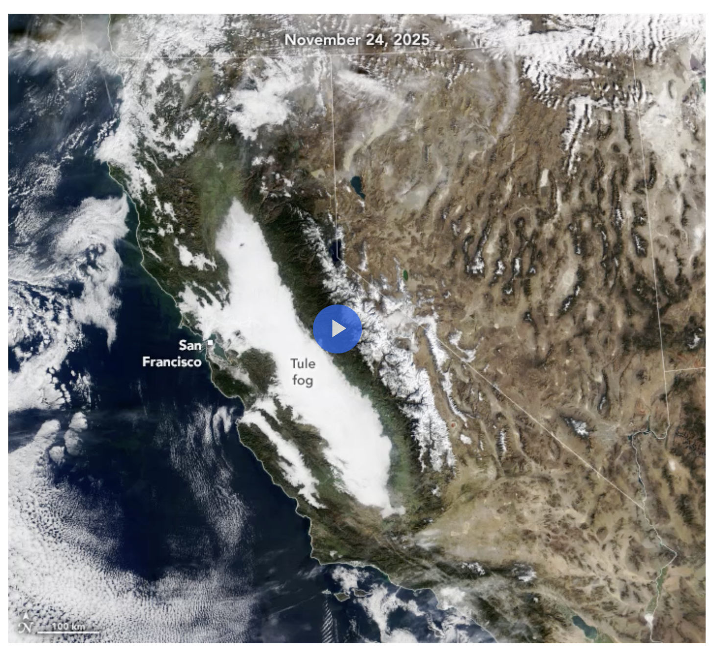
Going on three weeks, the Central Valley has been shrouded in Tule fog that could finally clear with a wet pattern coming into the state in late December. The extent of the fog that spreads over 400 miles is documented by this NASA satellite photo. and has spawned widespread news reports. The clouds tend to form in the SJ Valley in colder months when winds are light and soils are moist.
A wet XMAS for California
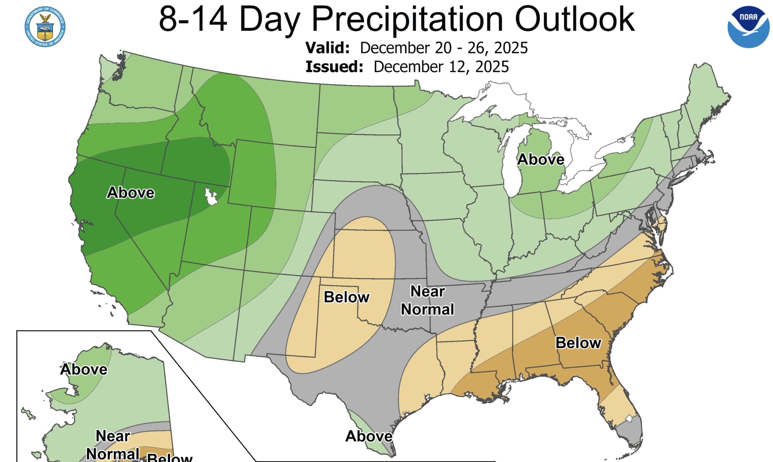
A pattern change is expected by next weekend as storms displace the famous blob of high-pressure that has been sitting off the coast blocking incoming systems or steering them to the north. A series of storms will be coming into the state in multiple waves dropping precipitation, particularly in the central and northern Sierra. The storms could be warm, continuing the pattern of low snowpack so far this year in the western US. The Climate Prediction Center published this map to show where precipitation is likely to fall..
Snow Drought Takes Hold Across the West
Water Year 2026 precipitation to date is near or above median for many parts of the West. However, much warmer-than-normal temperatures caused precipitation to fall as rain instead of snow across many basins, leading to snow drought despite wetter-than-normal conditions across most of the West.
Nearly every major river basin in the West experienced a November among the top 5 warmest on record.
Snow drought is most severe across much of the Sierra Nevada in California, the Cascade Range in Washington and Oregon, the Blue Mountains of Oregon, and the Great Basin in Nevada, with snow water equivalent (SWE) in most of these basins at less than 50% of median.
Here is the latest statewide snowpack report showing N Calif is just 6% of average to date.

Cold and wet weather is needed to improve snowpack conditions. Sierra ski resorts are hoping it chills out after an early start to the season. Chin Peak closed this week but hopes to reopen next Saturday with colder weather expected.