
February 5,2014
Parts of California should see rain and snow over the next five days starting tonight,Wednesday.
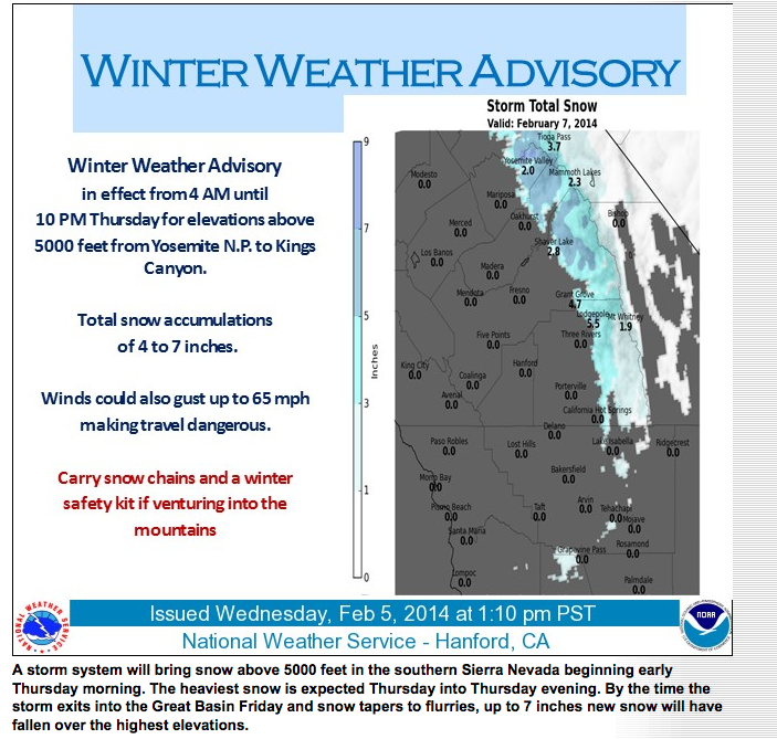 The town of Redding – next to the state’s largest reservoir- Lake Shasta expects rain through Monday with the most widespread storm across the state Thursday.NWS Hanford expects snow accumulation of up to 7inches from Yosemite down to Kings Canyon (see graphic).
For the Central Coast, SLO forecaster John Lindsey says on Thursday “Total rainfall amounts are expected to range from nearly three-quarters of an inch along the coast and one-quarter of an inch inland. Snow levels are expected to drop to 3,500 feet.”
“The long-term forecast for February calls for slightly above normal temperatures and below average rainfall for the Central Coast. March should feature slightly above normal precipitation and temperatures. April should be overall colder than average and wetter than normal.”
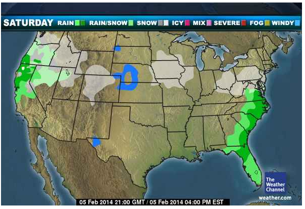
The adjacent map shows expected rain over the weekend including Sunday looking similar with the heaviest rain coming in Northern California including the Tahoe area where snow is starting to build up.
NWS Reno is calling the storm pattern an”atmospheric river” with subtropical moisture being aimed at norther California” like a fire hose.” Tahoe area could see over 4 ft of snow by end of weekend.