
Snow finally hitting the Sierra
-January 12,2024-
Don’t panic about the dry start to winter just yet. After last year’s incredibly wet rain and snow season, you’ve got to admit that so far, it’s been a disappointing start to 2024.
The deluge last year had huge impacts.California had record precipitation in 2022-23, with 31 atmospheric rivers helping to recreate Tulare Lake in Kings County. Statewide precipitation was 140 percent of normal, and the Sierra snowpack was over 200 percent of normal in April 2023. By some estimates, over a million acres of farmland were not planted in 2023 due to flooded land.
But so far this water year, a persistent high off the California coast is pushing storms well to our north re-creating fears of another drought year despite predictions of a strong El Niño effect in 2023/24.
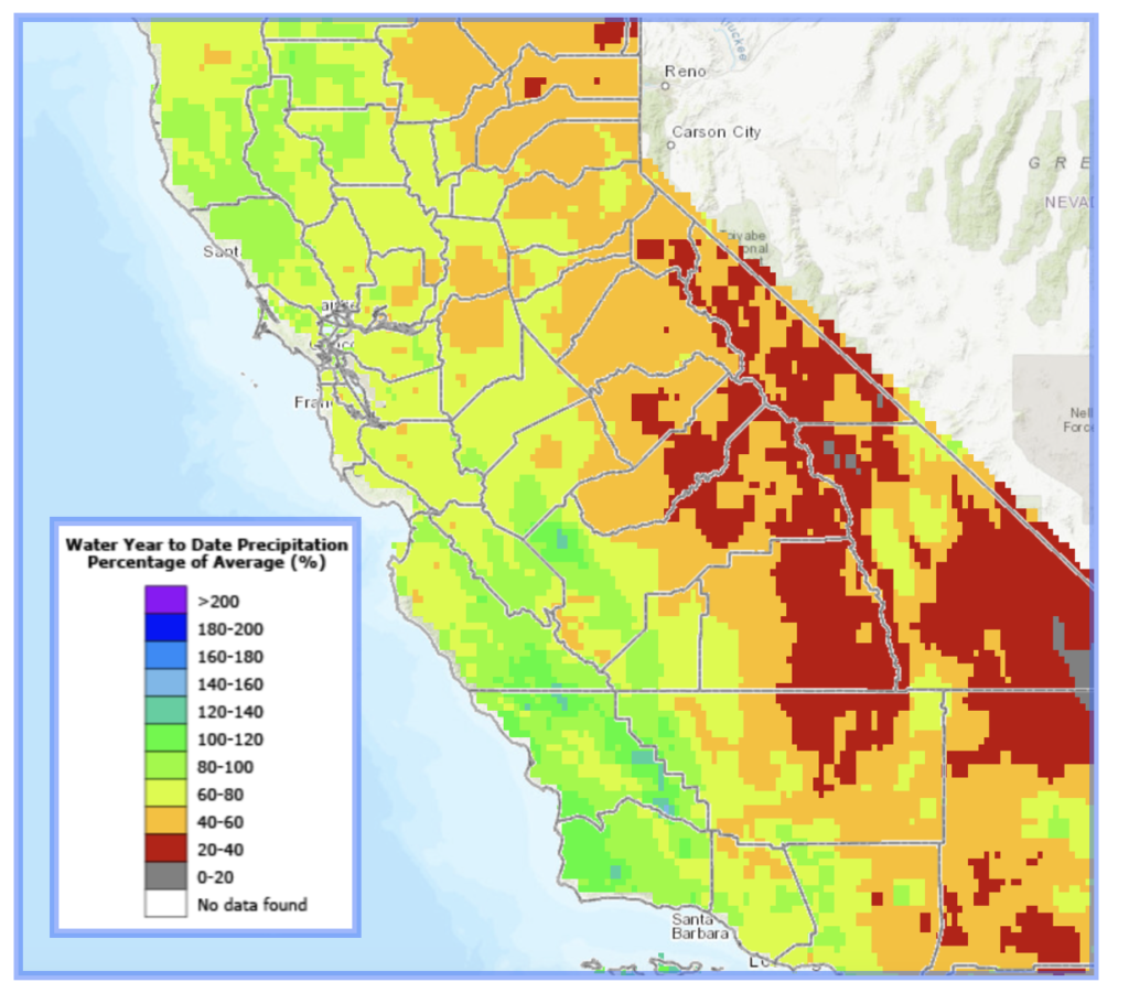 Looking at the latest statistics, the Central Coast and generally the entire coast of California have seen closer to average rainfall compared to much of the rest of the state, including the Sierra where snowpack has been slow to build.
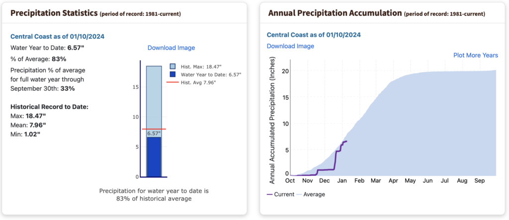 In fact the Central Coast stands at a respectable 83% of average as of January 10 says the California Department of Water Resources.Their precip map shows widespread green along the coast compared to red (20 to 40 % of average) along the Sierra crest.
But even in the Tahoe region for example, precip and snow numbers are picking up as of mid-January according to the UC Berkeley Central Sierra Snow Lab at Donner Pass. Today’s reading shows 27 inch of snow falling in the past 7 days with a water year accumulation of almost 71 inches compared to 118 inches- a 1991-2020 median number for this date.
Rain and snow accumulation is 71% of the average says the snow lab. Predictions of a cold and heavy snowstorm this weekend should help.
NWS Sacramento says to expect heavy snow in the mountains Friday night through Sunday morning. Snow-covered roads, reduced visibility, travel delays, chain controls and road closures are all possible.1-2 feet of snow above 4500 feet in the Warning area and 4-8 inches above 3000 feet in the Advisory area. Snow levels of 2500-3500 Friday PM, rising to 4000-6000 by Saturday.
Good snowfall is expected in the south valley mountains as well, says the National Weather Service Hanford with 12 to 18 inches of snow expected. Area ski resorts like China Peak and Mammoth say they expect a good build to their snow trails which have been in some cases, thin to date.
Sequoia accommodations closed
Concerned about the backlog of facility repairs, and the prospect of more snow, Sequoia and Kings Canyon National Parks have closed all their overnight accommodations and most of their visitor services until mid to late March although you can still visit the majestic big trees.
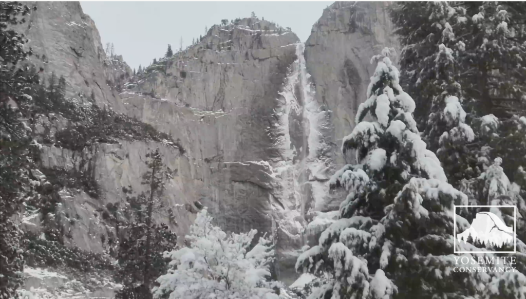
In Yosemite expect snow accumulation to top 23 inches this weekend. Here is a recent Yosemite Falls WebCam snapshot that will make you want to bundle up.
Thanks to Migration News for some info in is report