
-September 23,2023-
Weather models are predicting that this week’s atmospheric river event in late September may continue a wet pattern into October. The weather site Pivotal Weather is predicting as much as 18 inches of cumulative rain in northern California through the third week of October – about a month away. Over the same period, the northern Bay Area could see 4 to 6 inches of precipitation by October 20. The stormy weather could bring 4 to 5 inches to Lake Shasta, and the Tahoe area could get a heavy dose of early snow to kick off the ski season. The Pacific Northwest fire season could come to an abrupt halt with 20 inches of rain falling in Oregon and Washington as well as British Columbia.
The fire season has caused widespread smoke to drift over much of California this week affecting air quality.
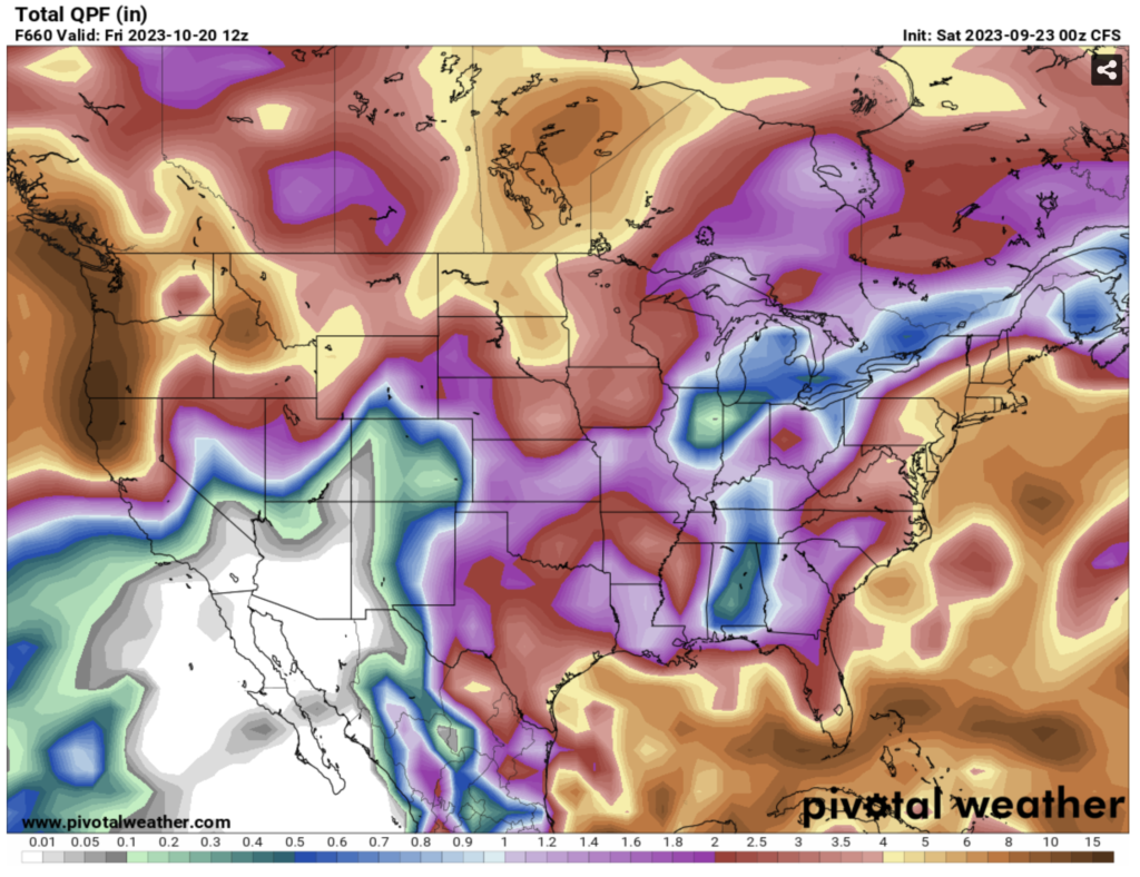
Weather reports this week suggest that the fall season’s first atmospheric river will douse fires in northern California in the coming days. The SF Chronicle reports “A major September storm is forecast to bring heavy rains and strong winds to Washington, Oregon and Northern California beginning Sunday night. … The jet stream is forecast to strengthen across the Pacific Ocean this weekend, pushing an atmospheric river all the way from Japan to the western U.S. Atmospheric rivers are ribbons of moisture that can ferry large amounts of moisture thousands of miles through the sky.”
The storm is expected to be one of several plunging down from the north into the Pacific Northwest extending south of the Bay Area.
The pattern change is both welcome and unexpected in the coming El Nino year with southern California anticipated to get more wet weather with comparative dry conditions in the Pacific Northwest.