
The spigot that appeared to be stuck on “on” for December but abruptly shut off before New Years now looks like it will stay off with predictions of relatively dry weather over much of California until the last week of January. So says LA forecaster Alan Fox who predicted the very wet storm pattern we got from late November through much of December.
As of January 1 California precipitation in northern California is 182% of average for the date says the state DWR and in the San Joaquin Valley the index stands at 145% of average. Snowpack averages are a little lower with the upper San Joaquin River index at 137% of average for January 1. Farewell Gap on the Kaweah already 48% of April 1 average with 3 months to go.Skiers are celebrating with China Peak saying they have 142 in. of snow on some parts of the mountain.
The drier weather in January could lead to some damaging freezes in Tulare County from around the 11-13 and 15-17 Fox says, a worry for the Valley’s citrus industry.
“Lucky we have received as much rain as we did“to bring on more fog that covers the sky like a blanket on cold nights.Fox says there could be some dry clear nights where the danger of low 20s temperatures could damage trees.
“Sea surface temps in the Pacific have changed since December but this is not unusual to have a dry period after a wetter than normal month.”
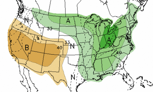
The US Climate Prediction Center is forecasting a dry month as well(see map).
Fox says he does see the storm door re-opening by the last week in January when he expects a return to wet weather. California’s Mediterranean climate gets most of its moisture by April annually,much of it stored in the snowpack.