
-November 6,2020-
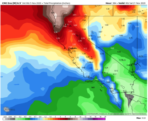
An Alaska born storm this weekend will bring colder temps, mountain snow, & coastal showers to Central California -helping to reduce the fire risk.The Central Sierra including the Tulare County mountains ,Tahoe and Mammoth could see as much as 12 inches of snow says NWS. Mammoth ski area says they will open November 15 as cold wether will also allow snowmaking.
NWS says “Two back to back storms will bring wet weather into much of the central California interior soon. It`s long overdue and it couldn`t be more welcome!
Not only will the precipitation douse the wildfires in the Sierra, but it will finally cleanse the atmosphere of smoke and particulate matter that has plagued the region since the middle of August. The storms this weekend will also usher in the coldest weather we`ve seen since early February.”
Snow levels will lower to about 4500 feet and accumulating snow above this elevation will produce wintry travel for motorists heading into the higher elevations. NWS says rain in the lower elevations, hasn`t fallen in any sizeable quantity since May 18th.
A break in precipitation should occur Saturday night before the second, colder storm system moves into central California Sunday.I-5 through the Grapevine and highway 58 through Tehachapi pass could conceivably become icy and/or snow covered late Sunday.)